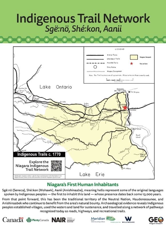
Long before today’s roads and highways, Indigenous trail systems connected people, places, and stories across what is now southern Ontario. According to Six Nations oral tradition, these pathways were used by hunters, traders, and diplomats to move between settlements, hunting grounds, gathering places, and trade routes.
Several of these historic routes still shape the landscape today. The Iroquois Trail followed the base of the escarpment from Albany through Queenston and Ancaster toward Detroit. The Mohawk Trail ran from St. Davids to Ancaster. Other important routes included the Niagara River Trail, which connected Niagara-on-the-Lake to Queenston, along with Lakeshore and Plank Road corridors that linked communities to fishing areas, waterways, and travel routes.
These trails are an important part of Niagara’s cultural landscape. They remind us that this region has long been a place of movement, exchange, diplomacy, and connection to the land.
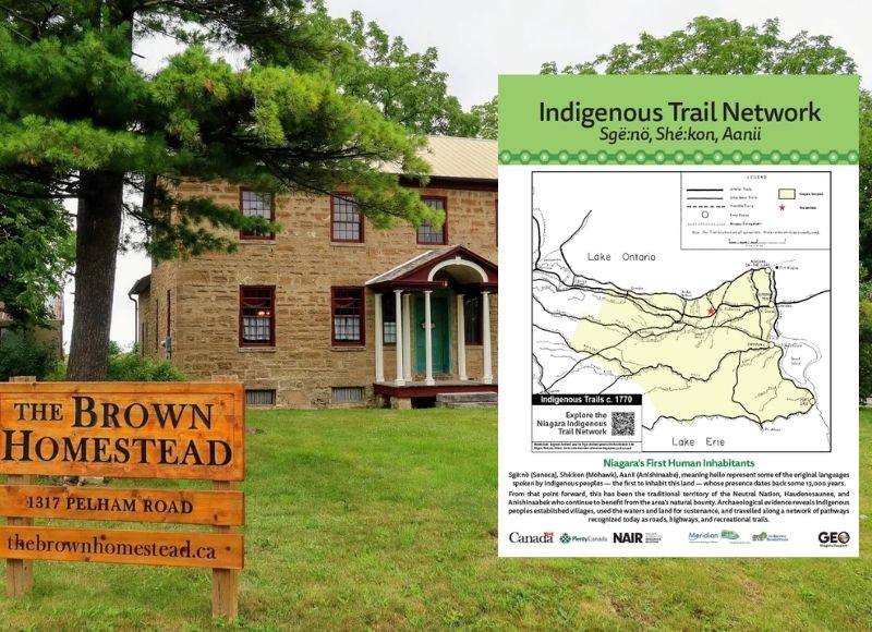
Indigenous Trails and Niagara Geopark
Niagara Geopark is working to help make these trail stories more visible through interpretation, education, and digital storytelling. This includes Indigenous trail signage, educational resources, and place-based experiences that help residents and visitors better understand the history and significance of these routes.
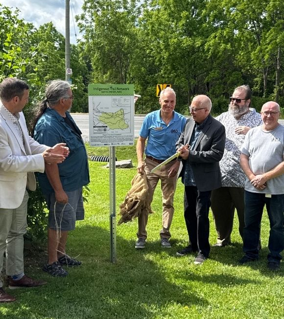
A key part of this work is Niagara Geopark’s partnership with the Niagara Academy for Indigenous Relations (NAIR). Through this relationship, Indigenous knowledge, voices, and perspectives help guide how trail stories are interpreted and shared. The Niagara Academy for Indigenous Relations serves as Niagara Geopark’s primary Indigenous knowledge advisory partner, supporting cultural protocols, engagement approaches, and the validation of Indigenous content across signage, digital tools, educational materials, events, and visitor experiences. This partnership helps ensure that Indigenous histories and perspectives are meaningfully embedded from the outset and shared with accuracy, respect, and integrity.
This work is also reflected in the Niagara Geopark Trail Network, a growing digital platform designed to connect trails, geosites, communities, and cultural landmarks across the region. Through this initiative, residents and visitors will be able to explore Niagara with a deeper understanding of the land, the stories it holds, and the Indigenous presence that has shaped it for generations.
Niagara Geopark gratefully acknowledges critical financial contributions from FedDev Canada, Plenty Canada and the Greenbelt Foundation, without which this important project would not have been possible. With their help we are strengthening digital interpretation, improving access to trail and cultural information and bringing greater visibility to Indigenous trails and sites that speak to the enduring Indigenous presence across the Region.
By bringing greater visibility to Indigenous trails, Niagara Geopark is helping tell a fuller story of Niagara. It is a story of relationship, knowledge, movement, and enduring Indigenous presence across the region.